Traffic Cast
Korea's subways, buses, trains and flights on one moving map: Traffic Cast
Traffic Cast draws Korea's subways, city buses, KTX trains, express buses and flights on one map. What is live, what comes from timetables, and how to use it.
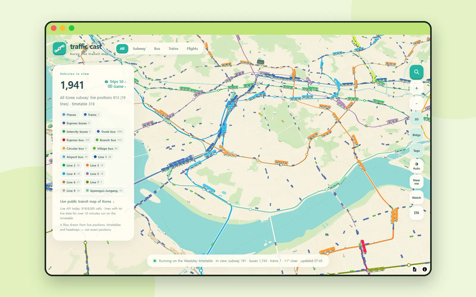
A subway line on a route map is a still picture. On Traffic Cast it moves: small trains slide along Line 2, buses follow the main roads, KTX trains run between cities and planes come and go around Gimpo. Traffic Cast is a map of Korea's public transport in motion, with subways, city buses, trains, express buses and flights on one screen in your browser. It is built for watching how the country moves, and it is open about which parts are live and which are drawn from timetables.
ZZXXCCVV siteTraffic CastKorea’s subways, buses, trains and flights, moving on one mapOpen1. Choose what to watch
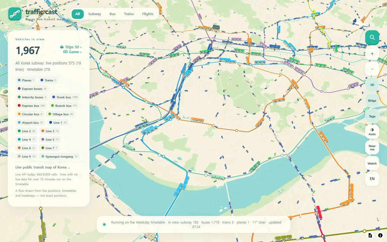
The buttons at the top pick what is on the map: All, Subway, Bus, Trains and Flights. You can turn on more than one, such as Subway and Bus together, and All brings everything back. If you choose only Trains or only Flights, the camera pulls back to show the whole country.
The panel on the left counts the Vehicles in view for the area on your screen and lists coloured chips for each subway line and bus type. The bar at the bottom tells you which timetable is running today (weekday, Saturday, Sunday or holiday), how many vehicles of each kind are in view, the local weather and when the data was last updated.
The buttons on the right handle the view:
| Button | What it does |
|---|---|
| 3D | Tilts the map |
| Bldgs | Building silhouettes when you zoom in |
| Tags | Route numbers above vehicles when you zoom in |
| Auto | Switches the map between day and night (Auto → Day → Night) |
| Near me | Moves the map to where you are, after the browser asks for permission |
| Watch | Watch mode (section 6) |
| EN | Language: 한국어, English, 日本語, 简体中文, 繁體中文, Español |
2. What is live and what is estimated
The small print under the panel says it plainly: "A flow drawn from live positions, timetables and headways — not exact positions." Each kind of vehicle is drawn a little differently, and the card you open by tapping it says which method it uses.
| On the map | How its position is drawn |
|---|---|
| Seoul-area subway (19 lines) | Live train positions. A line with no live data for over 10 minutes runs on its timetable instead |
| Subways in other cities, such as Busan | Timetable |
| City buses | Live positions on some routes; the rest run on their headway, the scheduled gap between buses |
| Trains (KTX, SRT, ITX, Mugunghwa and others) | Korail's operating records, which it publishes a day late, used as today's timetable. Not live, and train classes are inferred from train numbers |
| Flights | Takeoff and landing times are real; the position in the air is estimated from them. International flights are drawn only within about 450 km of the peninsula |
| Express and intercity buses | Timetable, or an arrival forecast where one is available |
3. Tap a vehicle
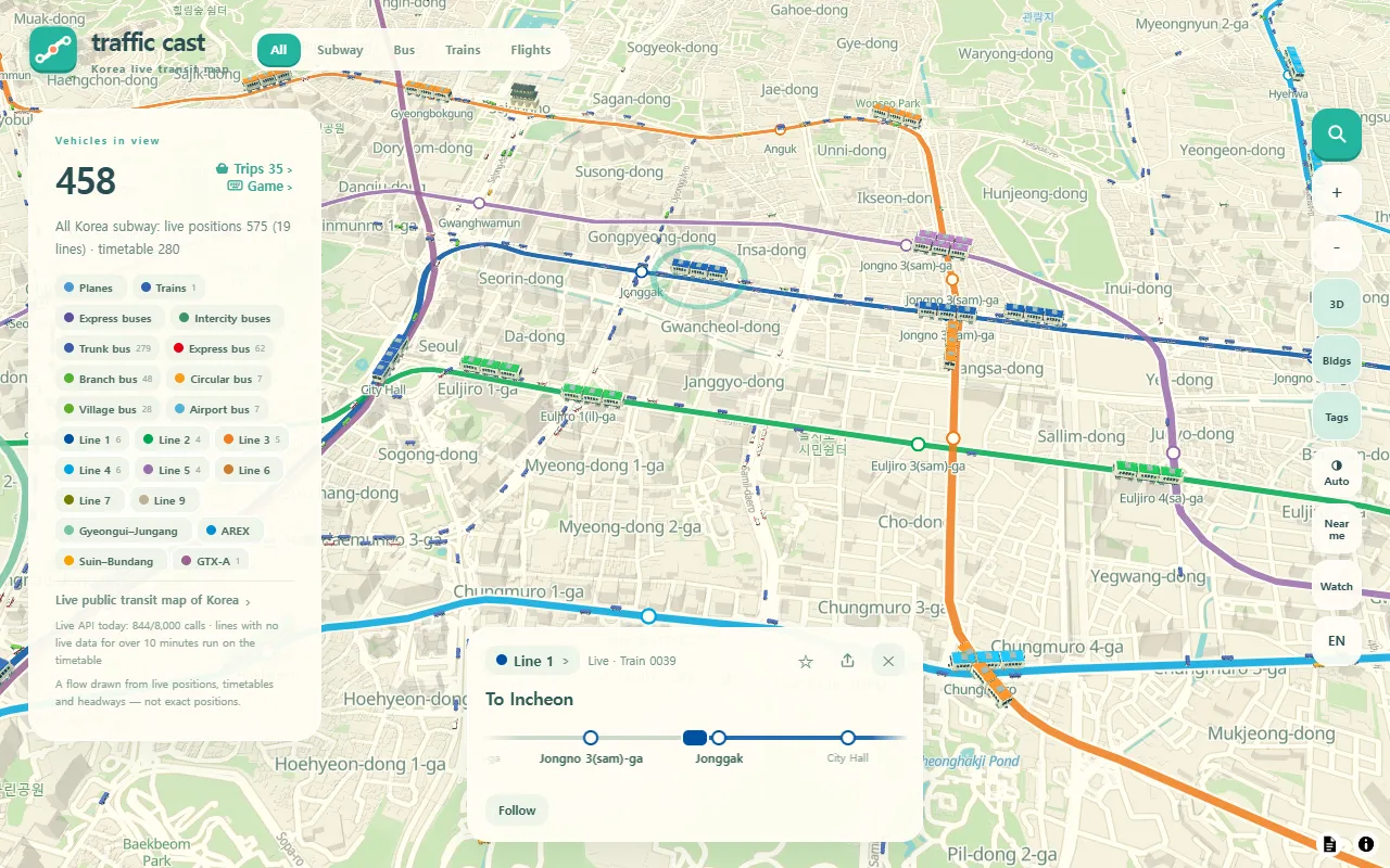
Tap any train, bus or plane to open its card. For a subway train you get the line, whether it is Live or running on the Timetable, its destination, a strip of the stations around it and where it is now, such as "Stopped at …" or "Next: …". For a bus, the card shows the route number, the stops ahead and the headway, for example "Every 11 min".
- Follow keeps the camera on that vehicle as it moves.
- ☆ saves the route to your favorites (subway and bus).
- The share button copies or shares a link that opens the same vehicle or place for someone else.
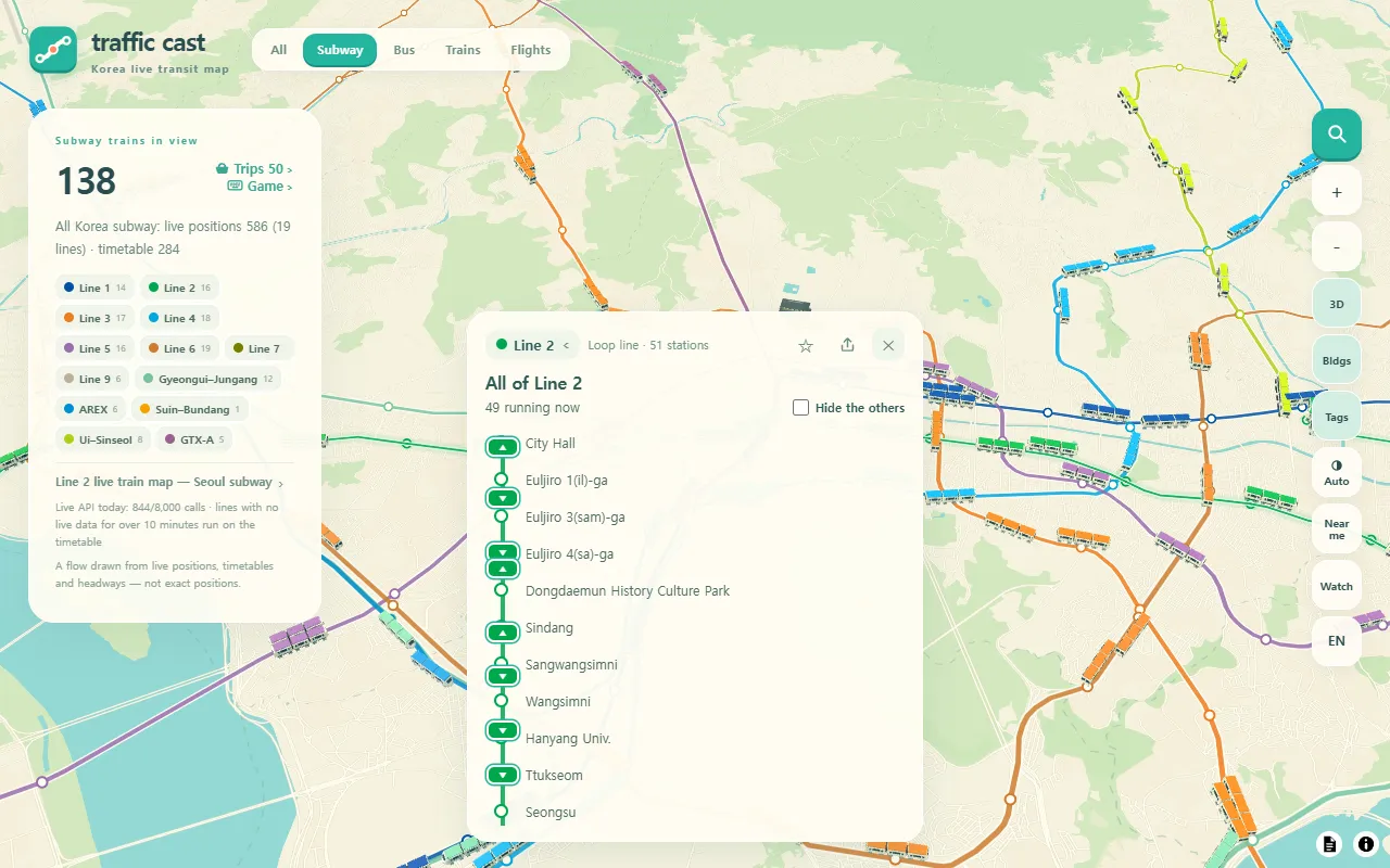
Press the line name at the top of the card to see the whole route: every station in order, with each train on the line marked by its direction. Tick Hide the others to hide every other vehicle on the map.
4. Search a station and see what is coming
Open search with the magnifier at the top right, or press /. You can look up stations, bus stops, bus numbers, subway lines, airports and terminals, and names typed in English letters work too, such as "Gangnam".
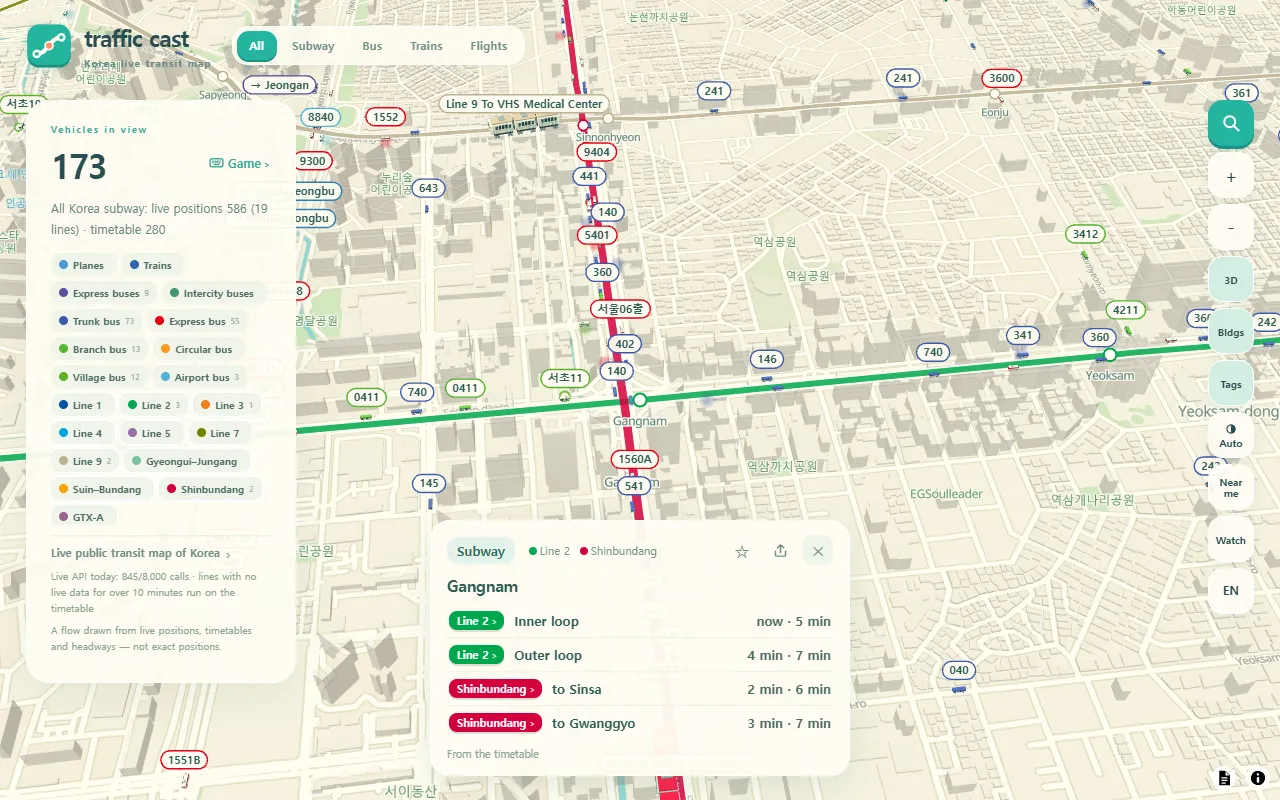
Pick a station and the map flies there and opens an arrival card with the next two trains in each direction. The note at the bottom, "From the timetable", is a reminder that these times are calculated, not announced by the station. Other places show what suits them:
- Airports: departures and arrivals from the airport's flight information, marked "delayed" or "cancelled" when that applies.
- Bus terminals: departures and arrivals from timetables and express bus forecasts.
- Bus stops: buses on live routes are estimated from their positions; on other routes you see the headway.
When the search box is empty, it shows your Favorites and Recent places.
5. Trains and flights across the country
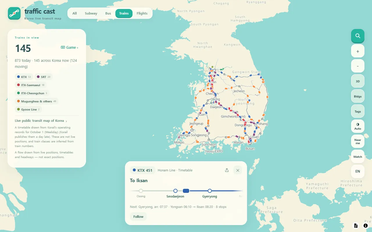
Choose Trains on its own to see trains across Korea, coloured by class: KTX, SRT, ITX-Saemaeul, ITX-Cheongchun and Mugunghwa & others. The panel shows how many trains run today and names the day whose operating records the map is using. A train's card lists its line, next stop and arrival time, and its first and last stations.
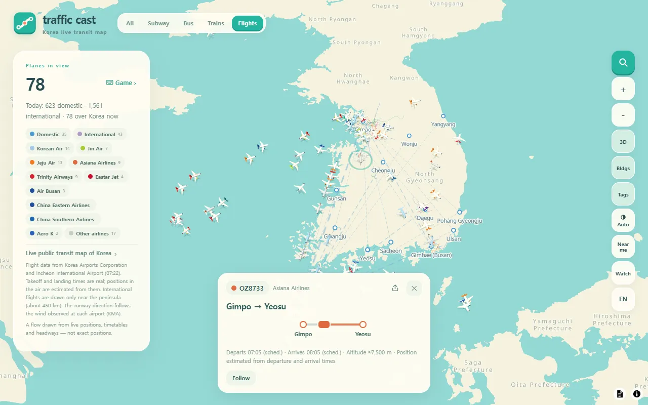
Flights shows planes over Korea, with chips for domestic and international flights and for each airline. A flight's card shows the flight number, airline, route, departure and arrival times (with the scheduled time when they differ), and approximate altitude. It also says, every time, that the position is estimated from departure and arrival times.
6. Leave it running: Watch mode
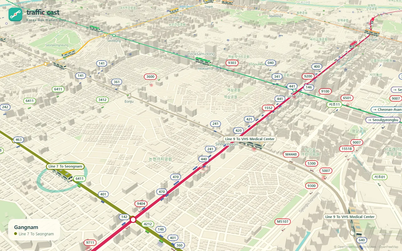
Press Watch and the panels and buttons disappear. The camera drifts from scene to scene, from Seoul neighbourhoods and airports to cities such as Busan and Daegu, and follows a vehicle in each one, with the scene name in a small caption. The site says it keeps the screen on, so it works on a TV or a spare monitor. Use Exit watch mode to come back.
A few addresses open the map in a set state, which is handy for bookmarks:
- A city: /en/busan, and likewise Seoul, Incheon, Daegu, Daejeon, Gwangju and Jeju
- A whole subway line: /en/subway/line-2
- Watch mode straight away: /en/watch
Coming up
In the next posts, we will keep introducing the ZZXXCCVV sites and how to use them.
Frequently asked questions
Are the positions on Traffic Cast live?
Partly. Seoul-area subway trains, some city bus routes, and flight takeoff and landing times come from live data. Other subway lines, the remaining bus routes, trains and express buses follow timetables or headways. The site describes the whole map as a flow, not exact positions.
Can I use it to catch a train or a bus?
It is better for seeing how things are moving than for timing a trip. Arrival times on station cards are calculated from the timetable, and train positions come from timetables, so check the operator's own information before you travel.
Do I need an account or an app?
No. Traffic Cast runs in the browser and has no sign-up. According to its privacy policy, favorites and display settings stay in your browser, and your location is used only to move the map.
Which parts of Korea does it cover?
The whole country. The site has its own pages for Seoul, Busan, Incheon, Daegu, Daejeon, Gwangju and Jeju, and trains and flights are shown nationwide.